Typhoon Guchol Ripping Across Japan Radiation is Spiking


Image

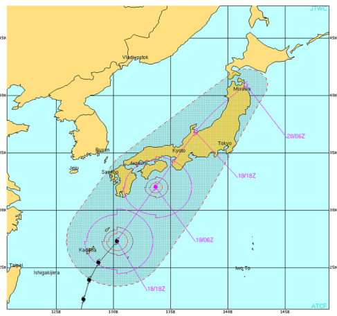
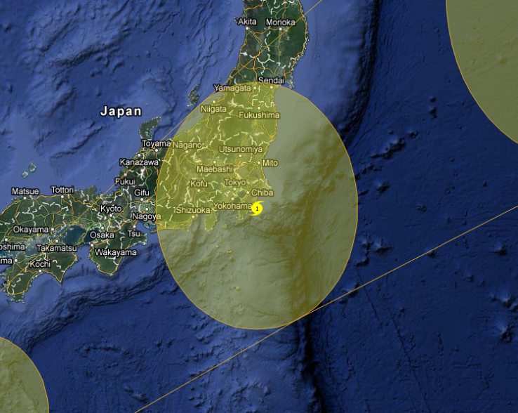
Typhoon Guchol is making its way northeast over the island of Japan at around 50 mph, with winds of 120 mph.  150,000 residents have been ordered to evacuate and the public transportation has been halted from Toyko to  the northern prefectures.

Tepco has not held a press conference or released any information regarding its devastated nuclear power plant.  At this point I assume any information will come from leaks or we will not find out the truth for weeks or months.

If you have a geiger counter, start taking readings today and for the next 40 days (the time it takes the radiation to circle the northern hemisphere) and post your results here and  anywhere you can.

The storm is kicking up radiation as you can see on the charts.  Visit this guys blog:

http://fukushima-diary.com/2012/06/radiation-level-picking-up-in-typhoon/


More bad news as Japan failed to disclose the radiation maps taken by the United States directly after the March 2011 earthquake, tsunami and nuclear disaster.   The maps could have possibly aided in the rescue efforts.   The largest amounts of radiation flew northwest back on top of the island of Japan.   http://www3.nhk.or.jp/daily/english/20120619_23.html

Typhoon Guchol (Butchoy) Update 2 Media Blackout


Image

Typhoon Guchol is speeding towards Japan and hitting it within 24 hours.  As of today, the storm has 120 mph winds and would be classified as a category 3 hurricane in the atlantic ocean. The typhoon‘s eye has filled in and it is showing signs of slowing down and weakening.  16 inches of rain are expected in Japan as the typhoon moves northeast.   West of Tokyo, they expect mudslides and flooding.   There is a huge media blackout on the topic of this typhoon and the danger it poses when combined with the nuclear disaster in Fukushima that occured in early 2011.  A couple of days ago when I wrote my other post on this issue, as I researched the internet, links that I had visited minutes before were disappearing.  I checked my history and some of them still worked, but were not being indexed by Google.

The next 36 hours are critical! The forecast says that the typhoon will pass far west of Fukushima.  You can watch the wind change direction as the typhoon moves across Japan. (This also shows the danger zone Fukushima).  Note how the winds blow east over Japan then how the jetstream takes the air right over the radioactivity westward.  http://www.kachelmannwetter.de/japan/japan.html

http://www.stormsurfing.com/cgi/display_alt.cgi?a=npac_slp

http://japandailypress.com/typhoon-guchol-racing-towards-japan-194597

Super Typhoon Guchol (Butchoy) Update 1


Image

Butchoy has now become the season’s first “super typhoon” or that equal to a category 5 hurricane.  It is expected to miss the philippines, but officials warned of a storm surge.

As Butchoy advances north, it may hit Okinawa Japan the evening of June 17.  It is expected to be a category 1 storm by the time it reaches Tokyo and Fukushima prefecture, where it is expected to make landfall.  While the downgrade in strength of the storm is good, it also means that Butchoy will be moving slower, dropping large amounts of water at the damaged reactors.  Typhoon Butchoy (Guchol) could hammer the eastern seaboard until Thursday June 22.

http://www.wunderground.com/wundermap/?lat=17.3&lon=127.7&zoom=6&type=hyb&rad=0&wxsn=0&svr=0&cams=0&sat=0&riv=0&mm=0&hur=1&hur.wr=0&hur.cod=1&hur.fx=1&hur.obs=1&fire=0&ft=0&sl=0

http://www.westernpacificweather.com/2012/06/17/weekend-wespac-tropical-report-for-june-17-2012/

curiously this was offline for me (camera at fukushima daichi):

http://www.tepco.co.jp/en/nu/f1-np/camera/index-e.html

  • Top Clicks

    • None
  • Categories

  • Visitors

    free counters